The Sole Lawful Representative of the People of East Turkistan Under the Occupation of Communist China
Welcome to the virtual tour to east turkistan
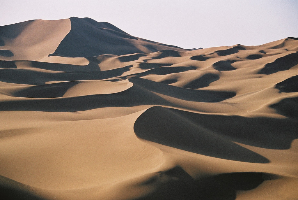
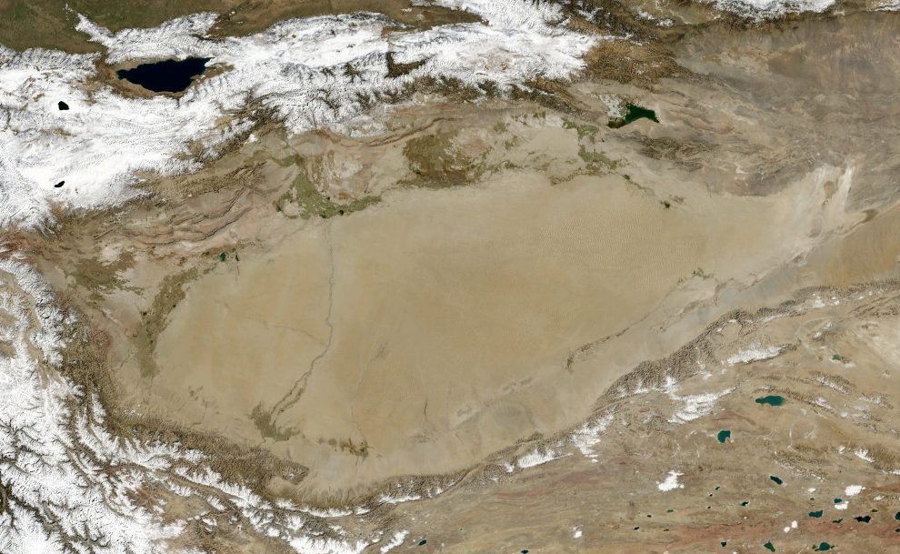
Taklamakan Desert
Located in Tarim Basin of East Turkistan, Taklamakan Desert has an area of 337,000 km2 (130,000 sq mi).
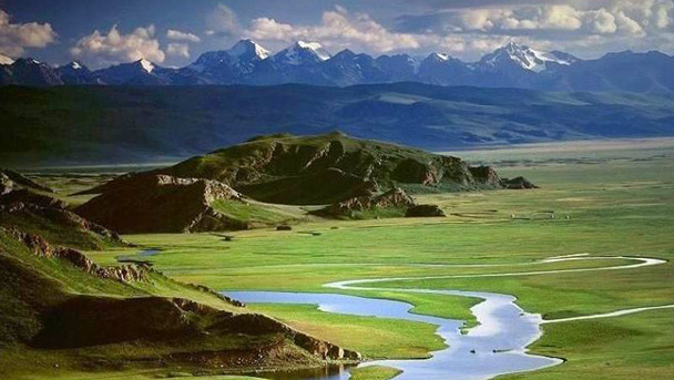
Bayunghulun Landscape
Located in Zhunghar Basin of East Turkistan, this is just one the many breathtaking landscape in Bayunghulun area.
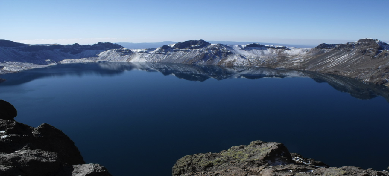
Lake Bughda
Located at the top of northern ranges of Heavenly Mountains (Tangri Taghliri), near Urumchi, this magnificent lake has an area of 1.892 mi².
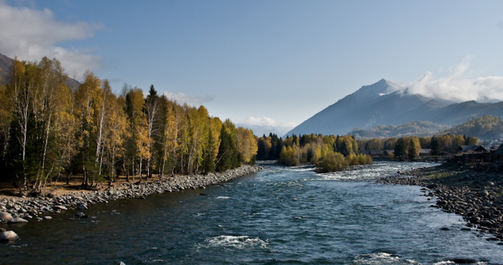
Altay Mountains
Located in the Altay prefecture of East Turkistan in the north, this breathtaking scenery if just one of the many landscape in the area.
EAST TURKISTAN: the parAdize of the land
EAST TURKISTAN: NOT “XINJIANG”
Chinese have come to call the land Xinjiang which means “the new territory” or “the new frontier.” It was a name applied in 1884 when the Chinese Imperial government formally annexed what had for centuries been known as “Sharqi Turkistan” — “The Land of the East Turks” that remained free and independent for centuries at the middle of Central Asia.
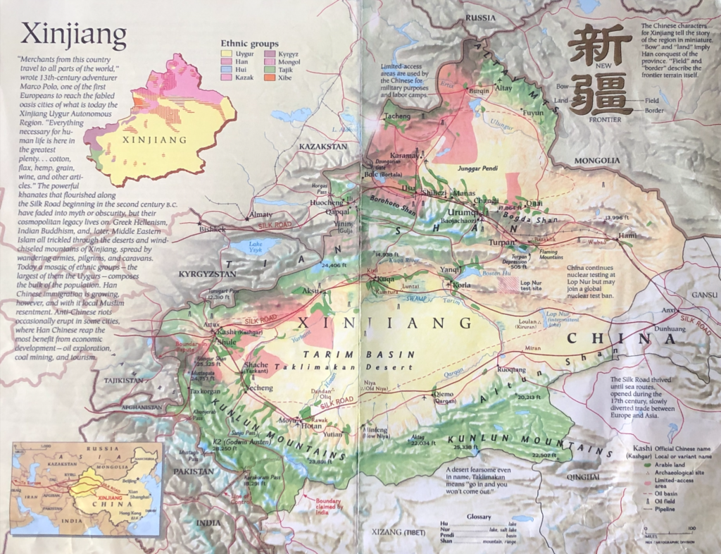
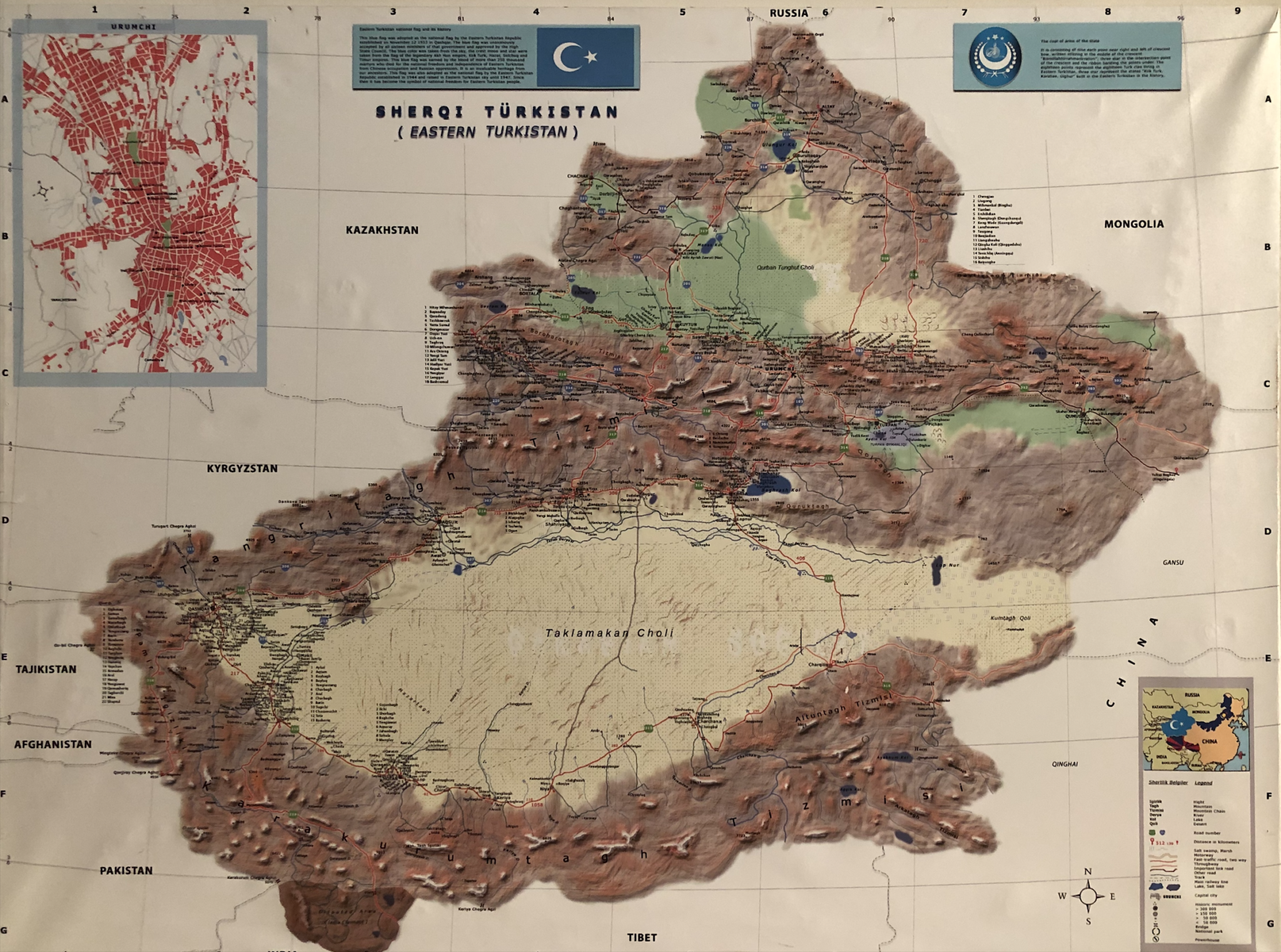
The Land Located in Central Asia, 1500 miles from Beijing, East Turkistan is bordered by Kazakhstan to the north, Mongolia to the northeast, and Kyrgyzstan and Tajikistan to the northwest and west. To the west and southwest lie Afghanistan and Pakistan, and to the south are Tibet and India. To the east lies China. This map on the right produced by National Geographic Society in Washington, DC with help of Anwar Yusuf Turani in 1997.
East Turkistan is a vast land of 640,000 square miles — one sixth the total of all China. Geographically, it is China’s largest province.
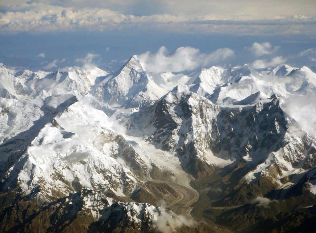
Mountains ring most of the land. To the north and northeast lie the Altay Mountains. The Tarbaghatay Mountains are in the northwest, forming part of the border with the former Soviet Republics. To the south are the Tibetan ranges: the Pamirs, the Karakorams, and the Karanghu (Kunlun) Mountains. To the east are the Altun Mountains which complete the circle. Only a few natural corridors pierce this wall of mountains. The Gansu corridor links the province to China proper, through the Gobi Desert. While Beijing has sought to strengthen that link, mountain passes to the north and west provide far easier access to the outside world — a fact which has shaped commerce, culture and history through the centuries.
Still another range of mountains, the Tangri Taghliri (Tian-shan), runs east to west across the province forming two basins: the Dzungharian Plain to the north and the much larger Tarim Basin to the south. Each basin has its own desert, but by far the largest desert — the Taklamakan —- is to be found in the extremely arid Tarim Basin. It is the largest desert in all China.
The extent of the deserts in East Turkistan is the most dramatic demonstration of the dryness of the climate. Far from any ocean, East Turkistan receives little rain. Its winters are cold and summers hot. Sandstorms are frequent. But for the rivers, fed by melting snow found on the surrounding mountains, much of East Turkistan would be completely unlivable.
tarim basin: southern east turkistan
Each basin has its own desert, but by far the largest desert — the Taklamakan is to be found in the extremely arid Tarim Basin.
Taklamakan Desert has an area of 337,000 km2 (130,000 sq mi), which is 1,000 kilometres (620 mi) long and 400 kilometres (250 mi) wide.
It is crossed at its northern and at its southern edge by two branches of the silk road as travellers sought to avoid the arid wasteland.
It is the world’s second largest shifting sand desert with about 85% made up of shifting sand dunes ranking 16th in size in a ranking of the world’s largest desert. Dunes range in altitude from 60 feet (18 m) up to as much as 300 feet (91 m).
JUNGGHAR BASIN: NORTHERN EAST TURKISTAN
The Junghar Basin is lower and less arid but considerably colder. This region is bounded on the north by the Altay Taghliri (Altay Mountains) and on the south by the Tängri Taghlari ranges. The Tängri Taghlari ranges include varied terrains.
In the east, the Turfan (Turpan) and Qumul Depression (Turfan is 60m below sea level) is the driest and hottest place in East Turkistan. In the west, the Ili Valley is the most area of East Turkistan most favorable for agriculture.
Ürümchi (Urumchi), the regional capital, is located in a large, relatively flat valley near the middle range.
As its traditional name implies, East Turkistan is a Turkic country populated primarily by Muslims who can trace their history back to at least the 7th century. Culturally, linguistically, even economically, East Turkistan is tied far more closely to nations which lie to its north and west than to its current overlord, China.